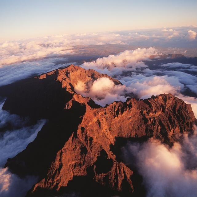
The five hikes in this guide are some of the island's most complete and most rewarding, and every one of them is based on the official trail data for distance, elevation gain and difficulty rating, so you know exactly what you're signing up for before you lace up.
They're ranked here from the most accessible to the most demanding. That doesn't mean the first ones are easy walks in the park, Réunion doesn't really do those, but they're a more reasonable starting point if it's your first time on the island's trails.
Before You Go
- A rental car is strongly recommended to reach most trailheads, several are well outside town centres.
- Weather changes fast and varies by microclimate, check conditions the morning of, not the night before.
- Start early. Most of these trails are best, and safest, begun before mid-morning.
- Trail status can change with closures for maintenance or weather, it's worth a quick check before you drive out.
- Bring more water than you think you'll need, proper shoes, and a light layer for altitude.
How the Ranking Works
- Each trail's difficulty comes from the official island trail registry, not a personal opinion.
- Duration and elevation gain are listed for an average pace, add time if you're stopping often for photos or a swim.
- "Who it suits" on each entry is a general guide, not a substitute for knowing your own fitness and experience.
Piton de la Fournaise
ModerateFrom Pas de Bellecombe · Volcano Enclos, the South
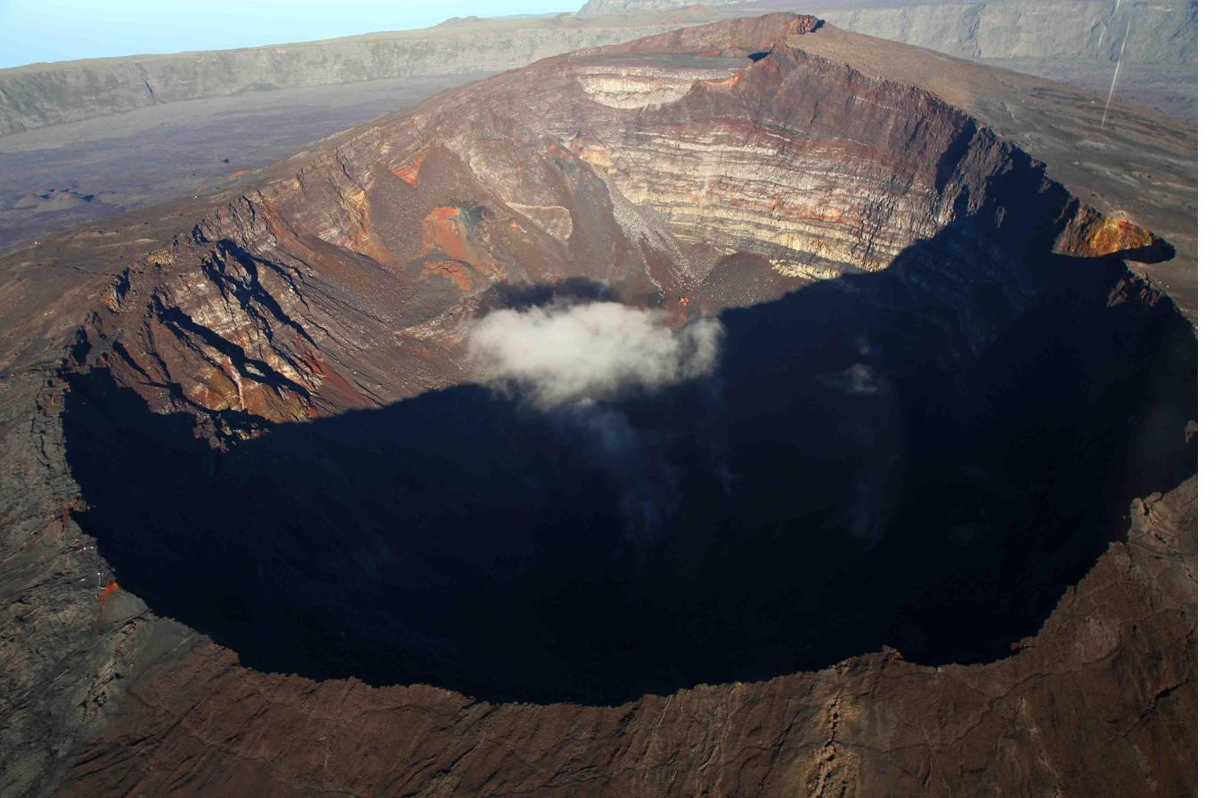
This is the most accessible of the five, and also the most unusual: you're walking across the caldera of an active volcano. From the Pas de Bellecombe viewpoint, the trail drops into the Enclos Fouqué before climbing to the crater rim of Piton de la Fournaise, one of the most active volcanoes in the world.
The path crosses a genuinely lunar landscape of hardened lava fields, a striking contrast to the green cirques elsewhere on the island. Because it sits inside an active volcanic zone, access depends on current activity, it's always worth checking that the area is open before you drive down.
A good fit for anyone with basic hiking fitness. The distance and elevation gain are the most modest of the five, but the terrain is exposed with little shade, so an early start and sun protection matter more than raw fitness here.
- Volcanic activity can close the trail with little notice, always confirm access before the drive out.
- There's no shade and no water source on the trail, carry everything you'll need for the day.
La Roche Écrite
ModerateFrom Mamode Camp · The North
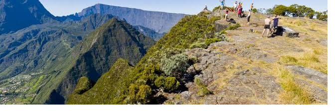
The Roche Écrite is the high point of the north of the island, and on a clear day the summit gives one of the best panoramas in Réunion, looking straight down into the cirque of Mafate, the one with no road access at all. It's also one of the last strongholds of the tuit-tuit, an endemic bird found nowhere else on Earth, so keep an ear out along the way.
It's officially rated a moderate trail, but don't let that undersell it, the elevation gain and distance put it firmly in full-day-hike territory. Most of the climb runs through forest, which at least keeps you out of the sun for the long middle stretch.
Best for hikers with some experience under their belt. It's not technical, there's no scrambling or exposure, but 1100 m of climbing over nearly 19 km is a serious full-day effort that rewards steady pacing.
- The summit is one of the last strongholds of the tuit-tuit, an endemic bird found only in Réunion.
- Most of the climb is under forest cover, useful shade, but also fewer views until you're higher up.
Sentier de la Chapelle
DifficultFrom Cilaos · Cirque de Cilaos, the South
Locally described as an "aquatic chapel with the air of a cathedral," this trail leads to a natural rock amphitheatre carved by water, one of Cilaos's more dramatic hidden features. It's shorter in distance than some of the others on this list, but the terrain earns its "difficult" rating with steep, technical sections along the way.
The reward at the end is very different from a summit view: an enclosed, almost sculptural space shaped by the river itself, tucked away from the rest of the cirque.
Suited to hikers comfortable with steep, sometimes technical terrain over a shorter distance. Sure footing matters more than raw endurance on this one.
- Shorter in distance than the others on this list, don't let that fool you into underestimating the pace needed.
- The trail can get slippery after rain, check conditions before heading out.
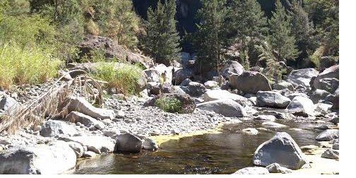
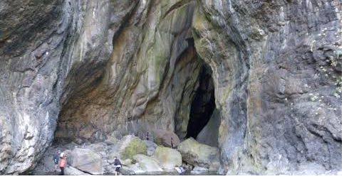
The river canyon leading toward the Sentier de la Chapelle, and the water-carved chapel itself at the end of the trail.
Aurère, via the Sentier Scout
DifficultFrom Le Bélier, Grand Îlet · Cirque de Mafate, via Salazie in the East
This is the one to pick if what you really want to see is Mafate, the cirque with no road access at all, reachable only on foot or by helicopter. From the trailhead near Grand Îlet in Salazie, the Sentier Scout crosses into Mafate and reaches Aurère, one of the cirque's small villages, tucked beneath the Piton Cabris.
The trail passes a narrow ridge section known as Deux Fesses, with cable handholds on the narrower stretch, then rolling forest and viewpoints most of the way to the village. It's mostly downhill on the way in, which means the return climb is where the effort really is.
Best for hikers who are fit and comfortable with steady climbing and a bit of exposure on the ridge section. The walk in is gentle, it's the 1200 m climb back out that makes this a demanding day.
- Aurère has several small gîtes, many hikers turn this into an overnight rather than a single long day.
- This is genuinely remote terrain, tell someone your plan and carry a paper map or offline GPS as backup.
Piton des Neiges
DifficultFrom Le Bloc · Cirque de Cilaos, the South
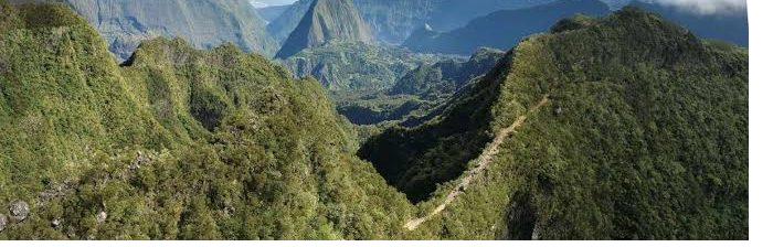
The big one. At 3070 m, Piton des Neiges is the highest point in Réunion and in the whole Indian Ocean, and this route from Le Bloc in Cilaos is the shorter but steeper of the ways up. Most people split it over two days with a night at the gîte near the summit, timed to catch sunrise from the top, one of the most talked-about moments on the island.
With 1730 m of elevation gain packed into 15.5 km, it's the longest and most physically demanding hike on this list by a clear margin, and altitude is a real factor near the top.
For hikers in strong physical condition with some multi-hour hiking behind them. If you're doing it as a sunrise summit, plan an overnight at the gîte rather than attempting it all in one push, both for safety and for the experience.
- Book the summit gîte well ahead, it's the most popular overnight on the island's trail network.
- Temperatures near the summit drop sharply overnight, pack warm layers even in summer.